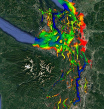
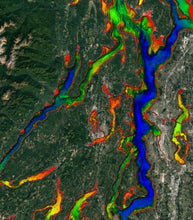
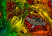
Puget Sound fishing map 3D with high resolution images of the seafloor.
**Preview map is LOW RESOLUTION. See gallery below for HD sample images**
- Description: Puget Sound fishing map features high definition 3D images of the seafloor.
- Location: Puget Sound fishing chart covers the Puget Sound waterways: Including Olympia, Tacoma, Seattle, Victoria, Port Townsend, Oak Harbor, Port Angeles, the San Juan Islands and the Strait of Juan de Fuca.
- Fishing Map Size: 7,200 square miles of potential fishing spots.
- Depths: 1 ft to 1,000 ft
- Works on: Lowrance, Simrad, Raymarine, B&G, VesselView, iPhone, iPad, and Android tablet.
- Resolution: Varies depending on the quality of data available. Lots of gorgeous high resolution areas. Some lower resolution, but best available areas.
- Notes: With StrikeLines’ HD view of the seafloor you’ll see exactly where those potential fishing spots are on the map. See where all the rocks, reefs, ledges, and other structures are in realtime on your GPS unit, mobile device, or computer. This is a huge chart with a large amount of very high quality sonar data. Huge boulder piles. 500 foot underwater cliffs. Pockmarked muddy bottom (possibly fish holes). This fishing map will absolutely put you on fish. Cod, halibut, flounder, rockfish.


