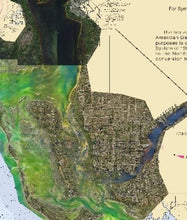
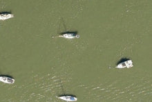
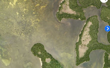
**Preview map is LOW RESOLUTION. See gallery below for HD sample images**
- Description: Ultra High-Definition aerial imagery for your chartplotter.
- Location: 4K aerial imagery for finding inshore fishing spots in Pine Island Florida, and includes: Placida, Boca Grande, Gasparilla Sound, Port Charlotte, Tom, Black Lake, Water Turkey Bayou, Pelican Bay, Pontoon Bay, Buzzard Bay, Pine Island Sound, Manatee Bay, Sanibel, Fort Myers Beach, San Carlos Bay, Pelican Bay, Hurricane Bay, Rocky Bay.
- Depths: Dependent on water clarity, normally 15+ feet.
- Works on: Simrad, Lowrance, and Raymarine.
- Resolution: Higher resolution than Google Earth in most areas with special processing to reveal more detail beneath the surface of coastal waters.
- Notes: See prop scars in the seagrass where scallops love to hang out. Find deep fishing spots in creeks for redfish. Navigate shallow cuts through the sawgrass in the marsh. Avoid rocks and sand bars. Fish longer and escape the flats when the tide is falling and water is getting skinnier by the second.


