This Item Comes with FAST FREE 1-3 Day Tracked Shipping!!!
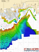
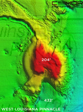
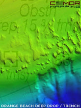
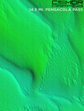
Released April 28th, 2021 - East Gulf of Mexico v3 includes a massive nearshore and deep drop addition throughout the entire map, a high detailed NOAA pipeline map with platform indicators, new inlet and shoreline coverage, wrecks, chicken coops, sound / bay coverage, Mississippi River and more!
The East Gulf of Mexico v3 CMOR Card offers unbeatable coverage and resolution for targeting everything from nearshore snapper to daytime swordfish.
Popular spots include:
-
Offshore Grand Isle
-
West Delta
-
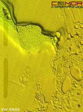
Offshore of SouthWest Pass
-
East of North Pass Mississippi River
-
Panama City, FL Offshore
-
Shelf Break from the Pinnacles due south of Pascagoula, up around and back down to the Twin Ridges just south of Madison Swanson.
-
DeSoto Canyon and the SPUR
-
Deep water from 500ft- 12,000ft throughout the East Gulf of Mexico
-
Tiger Shoal
-
Mississippi River
-
Lake Borgne
-
Chandeleur Sound
-
Mississippi Sound
-
Mobile Bay Middle Ground
-
Santa Rosa Sound
-
St. Joseph Bay
-
Mexico Beach
-
Apalachicola offshore
-
The Spur
NOAA Charts are included in the background
All CMOR Cards with the exception of Furuno are provided on Micro SD cards with a standard SD adapter included.
Furuno customers: Please note that CMOR imagery for Furuno is not sold as a physical card. You will receive an unlock code to access the imagery on your device. We will need your NavNet system ID in order to generate the unlock code. Additionally, Furuno users will receive East Gulf of Mexico v2.
CMOR CARDS ARE COMPATIBLE WITH THE FOLLOWING DEVICES:
Lowrance
-
HDS LIVE series
-
HDS Gen1 series
-
HDS Gen2 series (both keypad and touchscreen)
-
HDS Gen3 series
-
HDS Carbon
-
Elite HDI series
-
Elite CHIRP series
-
Elite Ti series
Simrad
-
NSS
-
NSS evo2
-
NSS evo3
-
NSS evo3 S
-
NSE
-
NSO
-
NSO evo2
-
NSO evo3
-
NSO evo3 S
-
GO XSE
-
GO XSR
Mercury VesselView
-
502
-
702
-
703
-
903
B&G
-
Zeus
-
Zeus Touch
-
Zeus2
-
Zeus3
-
Vulcan


